
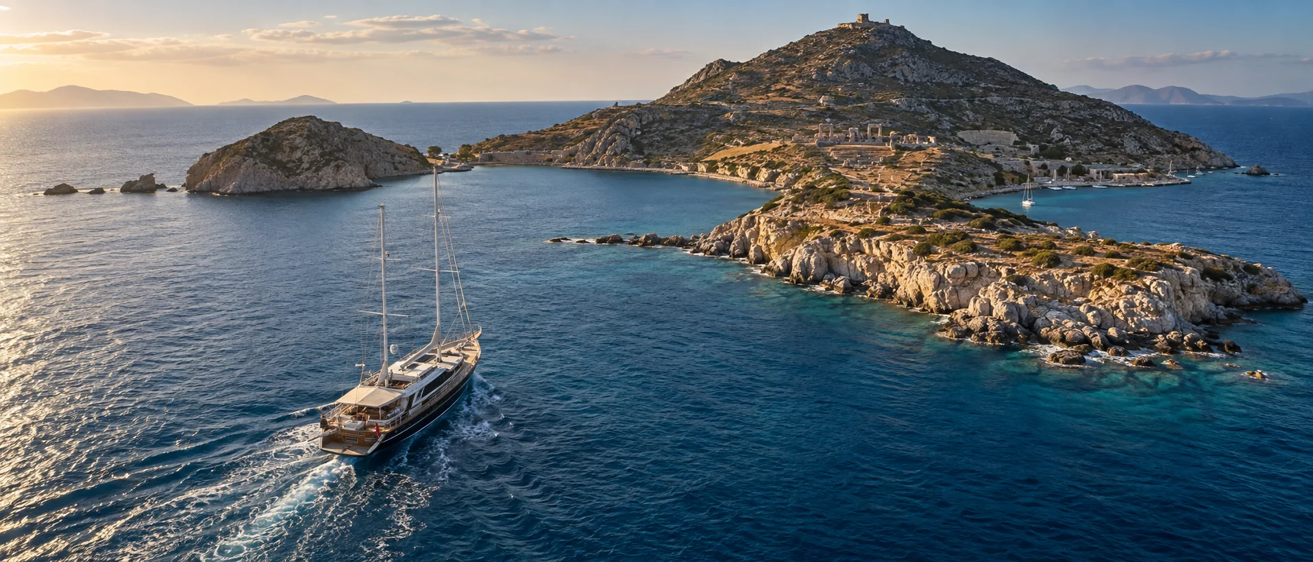
There is a line attributed to Can Yücel, who lived here and is buried here, about God having made Datça for people to grow old in. It is repeated on every menu on the peninsula and it is not why you should charter here.
The reason to charter Datça is more specific and more useful: it is the only cruising ground in Türkiye where the wind decides which coast you sleep on. The peninsula runs east to west for some eighty kilometres, dividing the Aegean from the Mediterranean. The north coast faces the Gulf of Gökova and takes the meltem full in the face across thirty miles of fetch, with only three genuine shelters along its entire length. The south coast lies in the peninsula's wind shadow and stays workable when the north is untenable.
Get that right and Datça is one of the finest weeks on this coast — empty water, an ancient city at the tip, and a food culture built on almonds, thyme honey and whatever the boat brought in. Get it wrong and you spend the week rolling.
Distances are in nautical miles from Datça town, timed at 8 knots for a gulet or Motor Sailer under power and 12 knots for a displacement motor yacht.
1. Arriving in Datça
By ferry — usually the right answer
The Bodrum–Datça ferry is the sensible route from Milas–Bodrum Airport, and it is worth knowing properly because the road alternative is punishing.
Operated by Bodrum Ferryboat, the crossing takes about 105 minutes from Bodrum Castle Port to Kairos Marina at Körmen, and it carries cars, SUVs, caravans, bikes and motorcycles. It runs year-round with the frequency scaling by season — three sailings a day through the first half of July, four a day from 15 July to 6 September, back to three to mid-September, and down to a single crossing on selected days from October. 2026 fares run around 875 TL one-way per passenger, 1,565 TL return, and 2,950 TL for a car.
By road
Milas–Bodrum (BJV) is 196 km by road — about 3 hours 30 minutes — because the road has to run all the way inland around the Gulf of Gökova. The ferry is faster, cheaper and considerably more civilised.
Dalaman (DLM) is 162 km via Marmaris, roughly 2 hours 45 minutes to 3 hours. This is the better airport if guests are flying commercially.
Marmaris to Datça is 75 km and about an hour and a quarter — a good surface on a winding road that narrows to the Bencik isthmus, where the peninsula is at its thinnest and both gulfs are visible from the ridge. Herodotus records that the Knidians once tried to dig a canal through it and gave up. It is worth the stop.
Berthing — and one correction
Kairos Marina (Körmen Limanı) is the peninsula's only full-service marina, on the north coast about nine kilometres from Datça town. 246 wet berths and 256 hardstanding, three to six metres depth, a 100-tonne travel lift, fuel by tanker delivery over 200 litres, showers, laundry, restaurant and hotel. It is also the ferry terminal, which makes it the natural technical base and crew-change point. It faces north-west, so the ferry wash and the meltem are both facts of life.
Datça town quay is run by the municipality — around 40 boats, depths to five metres over sand and mud, with electricity, water, ice, gas and laundry, and customs and a port agent on site: Datça is an official port of entry. It is sheltered from the north and exposed to southerlies. The northern basin is shallow and fair-weather only.
Palamutbükü and Hayıtbükü have no marina — small municipal and fishing jetties and restaurant lazy-lines, anchor-and-line-ashore, no fuel and no lift. Provisioning is village markets.
Do not put "D-Marin Datça" in a proposal. It does not exist. D-Marin's Turkish marinas are Didim, Göcek and Turgutreis. And the new Datça Yat Limanı, approved in 2024 for 270 berths, has preliminary works and a live annulment lawsuit — it is not operational and should not be described as such.
2. Ashore: Knidos and the Old Villages
Knidos
At Tekir Burnu, the very tip of the peninsula, where the Aegean meets the Mediterranean and every ship on the ancient grain route had to round the cape.
Knidos was a Dorian city with two harbours — one facing north, one south, so that a vessel could always find shelter whichever way the wind blew, which is the whole reason the city existed and made money. On the terrace above stood the round temple of Aphrodite Euploia, built to hold the Aphrodite of Knidos by Praxiteles: the first monumental female nude in Greek art, so famous that Pliny records people sailing to Knidos specifically to see it. The statue is lost; the temple foundation is not.
Eudoxus of Knidos, the astronomer and mathematician who first modelled planetary motion with concentric spheres, was from here, and the terraced structure traditionally identified as his observatory is on the site.
2026 practicalities: open 08:30–21:00 daily with no closing day, ticket office closes 20:30; entry around €5, Müzekart valid. A conservation project reached provisional acceptance in 2026, adding defined visitor routes, expanded parking and erosion protection — expect marked paths rather than free roaming. Excavation continues.
Anchoring at Knidos is a different question — see section 4.
The villages
Eski Datça — the restored old stone village two kilometres inland, bougainvillea over the lanes, boutique hotels, galleries and Can Yücel's house. Walkable, and best in the evening.
Reşadiye — the village above the town, with the Mehmet Ali Ağa Konağı, a restored nineteenth-century Ottoman mansion now run as a boutique hotel. Worth a look even if you are not staying.
Kızlan windmills — about seven kilometres out on the Marmaris road, two-storey stone mills placed in a natural wind funnel. Some restored into houses and restaurants, others left derelict, with modern turbines on the ridge behind them making the same point six hundred years later.
Hızırşah — a Seljuk-period mosque with distinctive stonework and a village culture house.
Emecik — the sanctuary of Apollo, near Karaincir.
Mesudiye — the hill village that governs the three southern bays.
3. The Table: Almonds, Thyme Honey and the Village Fish House
Datça's local shorthand for itself is "the three B's" — bal, badem, balık. Honey, almond, fish. It is accurate.
The destination table
Yakamengen III, in Yaka village — MICHELIN Guide 2026, Selected, and the peninsula's only Michelin-listed restaurant. Chef Duru Akgül won the MICHELIN Young Chef Award for 2026. It sits in a restored olive-oil mill and the cooking is seasonal Mediterranean built on wild plants, endemic species and deliberately under-used fish — lionfish and flute fish among them, which is a serious sustainability position rather than a menu gimmick. Signature: patates hoplatması, sea purslane with baby potato and pastırma. Summer season only; confirm dates before promising it.
Elaki, Reşadiye — in the historic Koca Ev, cooking from the garden with a stone oven.
Kekik, on Kumluk beach in Datça — refined Aegean.
Culinarium, on the Datça harbour — modern Turkish and European, seafood-led.
Datça Vineyard & Winery (Datça Bağ), at Kızlan seven kilometres out — a vineyard restaurant with garden produce and a sunset terrace. Small-batch wine including a barrel blend; there is a marked vineyard route on the peninsula.
The village register
This is where Datça actually eats, and where the peninsula is at its best.
Liman, Palamutbükü — stone-oven fish and herb mezes, owner-run. Sarıhoş, Palamutbükü — on the beach, and the place for almond-crusted sea bream, which is the peninsula on a plate. Poyraz, Ovabükü — mezes and grilled fish. Nil Pansiyon, Ovabükü — courgette-flower dolma and goat's-milk pudding. Ada Pansiyon, Ovabükü — almond-and-vegetable cooking. Pepper, Hayıtbükü — beach mezes. Hüsnü'nün Yeri, Kumluk — classic rakı-and-fish. Datça Sofrası, Eski Datça — for the almond köfte. Zada Meyhane next door for the evening. Jale Wine Cellar and Mayan at Kairos Marina, for the nights you are berthed at Körmen.
These are small seasonal operations run by families. Ownership and opening dates change; have the captain call ahead rather than trusting a list, including this one.
What to eat
- Datça badem — the almond, dry-farmed and early-flowering, and the peninsula's identity. The varieties are worth knowing: Nurlu, the largest and most prized; Ak, creamy with a soft shell and often twinned; Karabağ, celebrated eaten green as çağla; diş bademi, soft enough to crack with a tooth; and Sıra, small, of which there are around thirty cultivars. Season: çağla in February and March, fresh almond in July, main harvest from August.
- Almond ice cream and badem ezmesi — the signature pairing. Also bademli kurabiye, bademli incir tatlısı and bademli tavuk.
- Honey — dark, intense çam balı from the high pine forest, plus kekik (thyme) and lavender honeys.
- Olive oil from the Eski Datça and Reşadiye groves.
- Deniz kestanesi — sea urchin, eaten raw off the rocky southern coves. Increasingly restricted; ask before anyone harvests.
- Wild herbs — kekik and adaçayı, which perfume the whole peninsula in June.
- The endemic Datça date palm (Phoenix theophrasti) is protected. It is a thing to look at, not a crop.
4. Bays and Anchorages: The Coast You Sleep On
This is the section that matters, and it is the one most guides get wrong.
The north coast (Gökova-facing) — exposed
The north coast runs roughly thirty-five miles and is largely open to wind and swell. There are only three genuine shelters along its entire length: Mersincik, Gölyeri and Körmen. Everything else is a calm-weather day stop and nothing more.
Körmen / Kairos (~5 NM from Datça town by sea round the isthmus) — the best all-weather option on this coast, with the marina. Ferry wash is constant.
Mersincik (~14 NM) — eucalyptus along the shore, and a fair overnight in a settled meltem. Katabatic gusts spill off the ridge behind, so take it seriously.
Gölyeri — the third shelter; day stop.
Kuruca Bükü, Çiftlik, Küfre, Kargı (north) — day stops in calm conditions. Untenable in a built meltem, and people try anyway every August.
The south coast (Hisarönü-facing) — leeward
This is the overnight coast for most of the season.
Datça town — sheltered from the north, exposed to the southerly lodos. Fine in summer, uncomfortable in the shoulder seasons.
Aktur and Karaincir — sandy and shoal, near the isthmus. Day stops, open to the south.
Kızılbük — day or settled overnight.
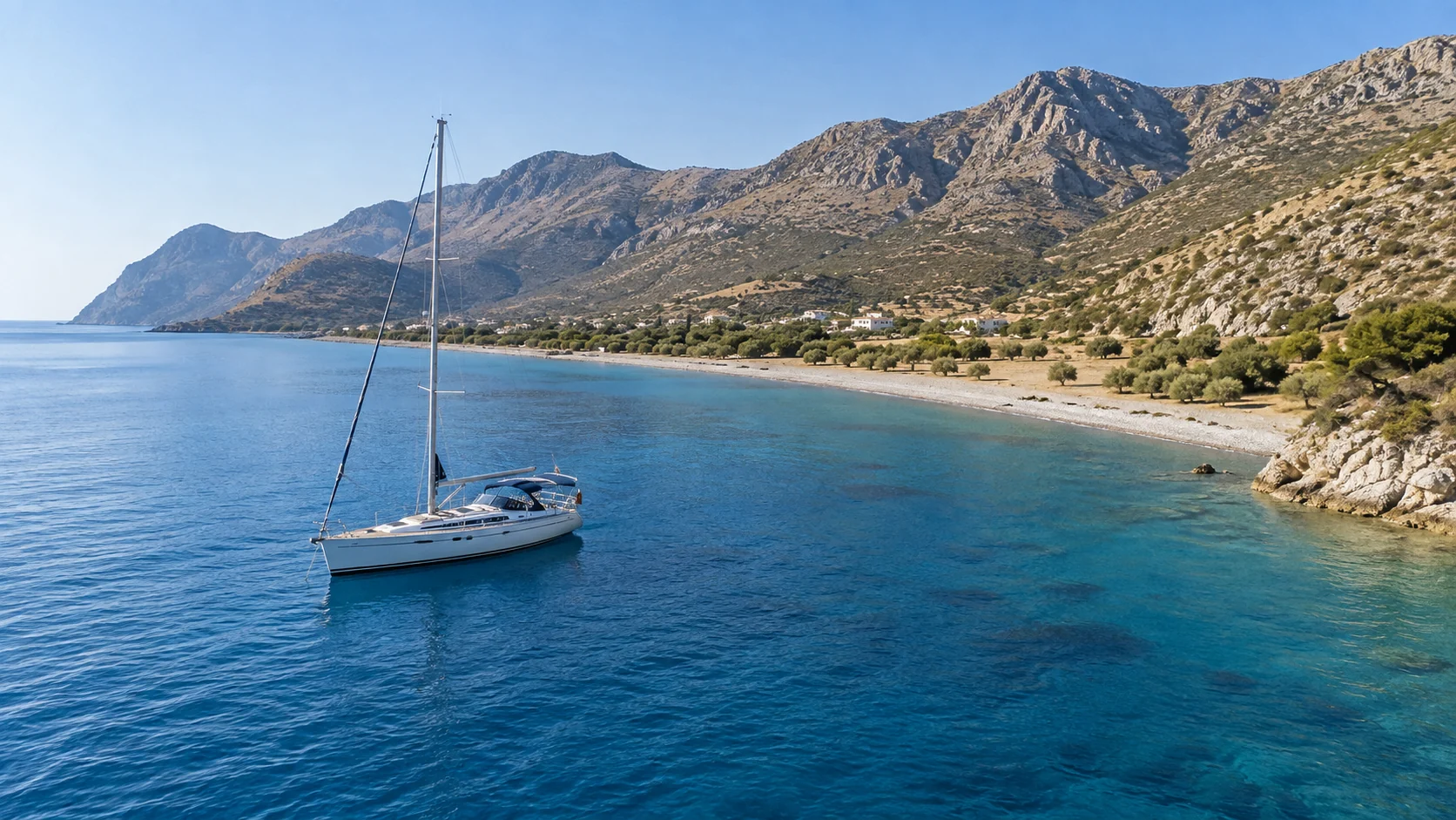
Palamutbükü — the long shingle beach with the restaurants. Overnight in settled weather, but open to the south and south-west and genuinely uncomfortable in a lodos.
Ovabükü — anchor in four to five metres on the western side, east of Kalaboshi Point. About five kilometres from Palamutbükü, and the bolt-hole used by yachts that have dragged at Knidos.
Hayıtbükü — the smallest and calmest of the three southern bays, and the best overnight on this coast.
Domuzbükü — boat access only, no facilities, day stop.
Bencik / Keçibükü — the long fjord-like inlet off the Gulf of Hisarönü at the peninsula's neck. The best all-round shelter associated with the peninsula, with three fish restaurants on pontoons and very little else. Covered from the other direction in the Marmaris guide.
Knidos itself
You anchor in the ancient commercial harbour, partly protected by the surviving mole, and it is one of the great anchorages of the Mediterranean for about four hours a day.
It is also settled-weather only. The holding is notoriously poor — rubble and amphora debris over a hard bottom — and yachts drag here regularly. The site sits inside overlapping first- and third-degree archaeological and first- and second-degree natural protection zones, and anchoring within the ancient harbour is restricted and discouraged. Plan Knidos as a morning arrival and an afternoon departure, with Ovabükü as the fallback if anything changes. Do not plan to sleep there unless the forecast is flat and the captain is content.
Regulatory note. The whole peninsula and its waters fall inside the Datça-Bozburun Special Environmental Protection Area, declared in October 1990 and covering 1,443 km². This was the first place in Türkiye where seagrass meadows received explicit protection, in the 2005 revision of the environmental plan — anchoring on Posidonia is prohibited and the plan mandates fixed moorings and buoys in designated bays in place of free anchoring. The Mediterranean monk seal is a protected species here; sea caves must not be entered.
Blue Card, 2026. A new regulation published in February 2026 and in force from 11 August 2026 turns the Blue Card into a fully digital waste-tracking regime covering all waste-generating yachts and boats, private and commercial, with every transfer registered by web or mobile and overseen by TÜÇA with provincial inspection. Every discharge must be logged digitally. Aquinox handles this; it is not the guest's problem, but it is not optional.
5. Four Route Alternatives
Route One — The Peninsula Circuit · 7 nights · ~85 NM
Round the peninsula, using the south coast for the nights and the north coast only when the forecast allows.
| Day | Leg | NM | 8 kn | 12 kn | Night |
|---|---|---|---|---|---|
| 1 | Datça town → Kargı Koyu | 3 | 0h25 | 0h15 | Kargı |
| 2 | Kargı → Aktur (swim) → Kızılbük | 5 + 6 | 1h25 | 0h55 | Kızılbük |
| 3 | Kızılbük → Ovabükü | 8 | 1h00 | 0h40 | Ovabükü |
| 4 | Ovabükü → Hayıtbükü (lunch) → Palamutbükü | 2 + 4 | 0h45 | 0h30 | Palamutbükü |
| 5 | Palamutbükü → Knidos (day) → Ovabükü or Knidos | 8 + 10 | 2h15 | 1h30 | Ovabükü (see below) |
| 6 | Ovabükü → round Deveboynu → Mersincik | 22 | 2h45 | 1h50 | Mersincik |
| 7 | Mersincik → Körmen (Kairos Marina) | 9 | 1h10 | 0h45 | Kairos |
| 8 | Körmen → Datça town | 5 | 0h40 | 0h25 | Disembark |
How it runs. The programme keeps the guests on the sheltered south coast for the first five nights and only commits to the exposed north coast on day six, when the captain has had a week of forecasts to look at. That is not caution — it is the correct way to plan this peninsula.
Day five is the day of the charter. Leave Palamutbükü at eight, run the eight miles west and anchor in the ancient commercial harbour at Knidos by mid-morning. Walk the terraces, the theatre, the round temple foundation and the two harbours. Then make a real decision at three o'clock: if the forecast is flat and the anchor is well set, stay — a night at Knidos with the ruins above you is one of the two or three finest nights available in Turkish waters. If there is any doubt at all, run the ten miles back to Ovabükü. Yachts drag at Knidos, and it is the wrong place to find that out at two in the morning.
Day six rounds Deveboynu. This is where the Aegean meets the Mediterranean and the wind compresses round the cape — expect ten to fifteen knots above the gradient and reef before you commit. Morning, always.
Route Two — The Southern Bays · 4 nights · ~40 NM
The short week, entirely on the leeward coast, and the right answer for guests who want to swim and eat rather than sail.
Datça → Kargı → Kızılbük → Palamutbükü → Ovabükü → Hayıtbükü → Datça.
Nights at Palamutbükü for dinner at Sarıhoş — the almond-crusted bream — and at Hayıtbükü, which is the calmest water on the peninsula. Lunch at Ovabükü, and a night's dinner in Eski Datça with a taxi from the town quay: Datça Sofrası for the almond köfte, Zada Meyhane afterwards, and the walk back through the stone lanes. Nothing on this itinerary exceeds an hour and a half.
Route Three — Datça to Bodrum and the Gulf of Gökova · 7 nights · ~90 NM · one-way
North and east, and the natural pairing for anyone who wants two very different weeks in one.
Datça → Körmen → Mersincik → Küfre → Değirmen Bükü / İngiliz Limanı → Sedir Adası → Çökertme → Orak Adası → Bodrum.
The first two legs are the exposed ones, and they should be morning legs without exception. Once you are across into the Gulf of Gökova the coast turns benign: pine-walled inlets, forty miles of protected water and the best anchorage in the region at İngiliz Limanı, where there is no shore power, no restaurant and no phone signal in the inner arm. Full detail in the Bodrum guide.
Route Four — Datça to Marmaris via Bozburun · 7 nights · ~80 NM · one-way
East along the Hisarönü shore, and the gentler of the two one-way options.
Datça → Kargı → Bencik / Keçibükü → Orhaniye → Selimiye → Bozburun → Bozukkale (Loryma) → Kumlubükü → Marmaris.
This is the leeward side of two peninsulas at once and it is remarkably sheltered. Bencik is the shelter of last resort and worth a night on its own merits. Selimiye has the best jetty restaurants on this coast, Bozburun still builds gulets by hand, and Bozukkale puts you under a Hellenistic fortress with no road to it. Full detail in the Marmaris guide.
6. Season, Wind and Which Coast to Sleep On
The meltem blows from the north and north-west, peaks in July and August, fills in the late morning and dies overnight. On this peninsula it does something specific and useful to understand.
The north coast takes it full on, with thirty miles of fetch across the Gulf of Gökova and three shelters in thirty-five miles of coastline. The south coast lies in the peninsula's wind shadow and stays workable — with the caveat that gusts spill over the spine as katabatics, and that in spring and autumn the southerly lodos reverses the whole picture and makes Datça town quay and Palamutbükü untenable.
Two acceleration zones matter. Deveboynu / Tekir Burnu at Knidos, where the two seas meet and the wind compresses round the cape. And the Hisarönü mouth off Bozburun. Expect ten to fifteen knots above the gradient at both, and reef before you round rather than after.
The planning rule that follows: north coast in the morning, south coast for the night, and never commit to Knidos on an afternoon forecast.
Sea temperature: annual mean around 20.7°C, peaking at 26.3°C in August and bottoming at 16.3°C in March. Comfortable swimming roughly June to October. The peninsula gets around three hundred sunny days.
- Late May and June — moderate meltem, warm water, berths available. The best of the year.
- July and August — the meltem peak, and the months when the north coast is closed more often than not.
- September and early October — the professionals' window.
7. Chartering from Datça with Aquinox
Aquinox Yachting is a TÜRSAB-certified brokerage and charter house operating across the Turkish Riviera, with full agency capability through our partnership with UCT Agency: berthing at Kairos and the Datça town quay, port clearance and transit logs at Datça's customs office, digital waste compliance, duty-free bunkering, provisioning and crew placement.
We do not publish vessel names. Our fleet is presented by specification and code, and the right yacht is proposed after we understand the party. Datça carries one genuine constraint worth stating: there is no travel lift or serious technical capacity beyond Kairos, and the nearest full yards are Marmaris and Bodrum. For a longer charter we plan a mid-week call at Körmen for that reason alone.
Request a Datça charter proposal — or continue east with our Marmaris route guide.
FAQ
Frequently Asked Questions
Is there a marina in Datça?
Yes — Kairos Marina at Körmen on the north coast, with 246 wet berths, 256 hardstanding and a 100-tonne travel lift. There is also the municipal town quay for around 40 boats, with customs on site. There is no "D-Marin Datça" despite what many charter sites claim, and the new Datça Yat Limanı is not operational.
How do I get to Datça from Bodrum?
The ferry. Bodrum Castle Port to Kairos Marina at Körmen takes about 105 minutes and carries vehicles, with four sailings a day at the height of summer. The road is 196 km and around three and a half hours because it must run inland around the Gulf of Gökova.
Which side of the Datça peninsula should I anchor on?
The south, for most of the summer. The north coast faces the Gulf of Gökova and takes the meltem across thirty miles of fetch, with only three real shelters — Mersincik, Gölyeri and Körmen — in thirty-five miles. The south coast sits in the wind shadow. In spring and autumn a southerly lodos reverses this.
Can I anchor overnight at Knidos?
Only in settled weather and with the captain's agreement. The holding in the ancient harbour is poor — rubble and amphora debris — and yachts drag regularly. The site is also inside overlapping archaeological and natural protection zones where anchoring is restricted. Plan a morning arrival and keep Ovabükü as the fallback.
What is Knidos worth seeing for?
Two harbours facing opposite ways so ships could always shelter; the round temple that held Praxiteles' Aphrodite of Knidos, the first monumental female nude in Greek art; the theatre; and the terrace associated with Eudoxus, who first modelled the planets. Open 08:30–21:00 daily, around €5.
What should I eat on the Datça peninsula?
Almonds, in every form the peninsula has invented — almond-crusted sea bream at Palamutbükü, almond köfte in Eski Datça, almond ice cream anywhere. Then thyme and pine honey, the local olive oil, and whatever fish came in that morning at a village jetty.
Is there a Michelin restaurant on the peninsula?
One: Yakamengen III at Yaka village, in the 2026 MICHELIN Guide selection, whose chef won the Young Chef Award for 2026. Summer season only. There are no starred restaurants on the peninsula — Muğla's stars are all in Bodrum.
What does a Datça charter cost?
It depends on vessel, season and party size, and any figure quoted without those is fiction. We build proposals against the itinerary. Ask us.


 English
 Turkish